Difference between revisions of "File:MH17-last-minutes.png"
(The green dots are the MH17 position transmissions, the red dots are the crash and ELB locations (overlaid by me). For use only in Talk page - not for publication as the underlying image is copyright Google/Satellite/mapping company.) |
(Two Dogs uploaded a new version of "File:MH17-last-minutes.png") |
||
| (7 intermediate revisions by 2 users not shown) | |||
| Line 1: | Line 1: | ||
| − | The green | + | The green arrows are the MH17 position transmissions, the red stars are the crash and ELB locations (overlaid by [[User:Two Dogs]]). |
| + | |||
| + | It is notable that the crash site lies @15Km to the North-West of the last position transmission, implying a direction of travel almost opposite to both the flight path as indicated by successive position transmissions and the reports of the disposition of the debris field. This is a conundrum alluded to in the [[Malaysia Airlines Flight 17/Russia's questions to Ukraine|Russian military briefings]]. It implies either a near U-turn just prior to the crash or an anomaly in the GPS system for the area at that time. It is an issue crying out for forensic examination --[[User:Peter|Peter P]] ([[User talk:Peter|talk]]) 10:26, 19 August 2014 (IST) | ||
Latest revision as of 14:59, 16 September 2014
The green arrows are the MH17 position transmissions, the red stars are the crash and ELB locations (overlaid by User:Two Dogs).
It is notable that the crash site lies @15Km to the North-West of the last position transmission, implying a direction of travel almost opposite to both the flight path as indicated by successive position transmissions and the reports of the disposition of the debris field. This is a conundrum alluded to in the Russian military briefings. It implies either a near U-turn just prior to the crash or an anomaly in the GPS system for the area at that time. It is an issue crying out for forensic examination --Peter P (talk) 10:26, 19 August 2014 (IST)
File history
Click on a date/time to view the file as it appeared at that time.
| Date/Time | Thumbnail | Dimensions | User | Comment | |
|---|---|---|---|---|---|
| current | 14:59, 16 September 2014 | 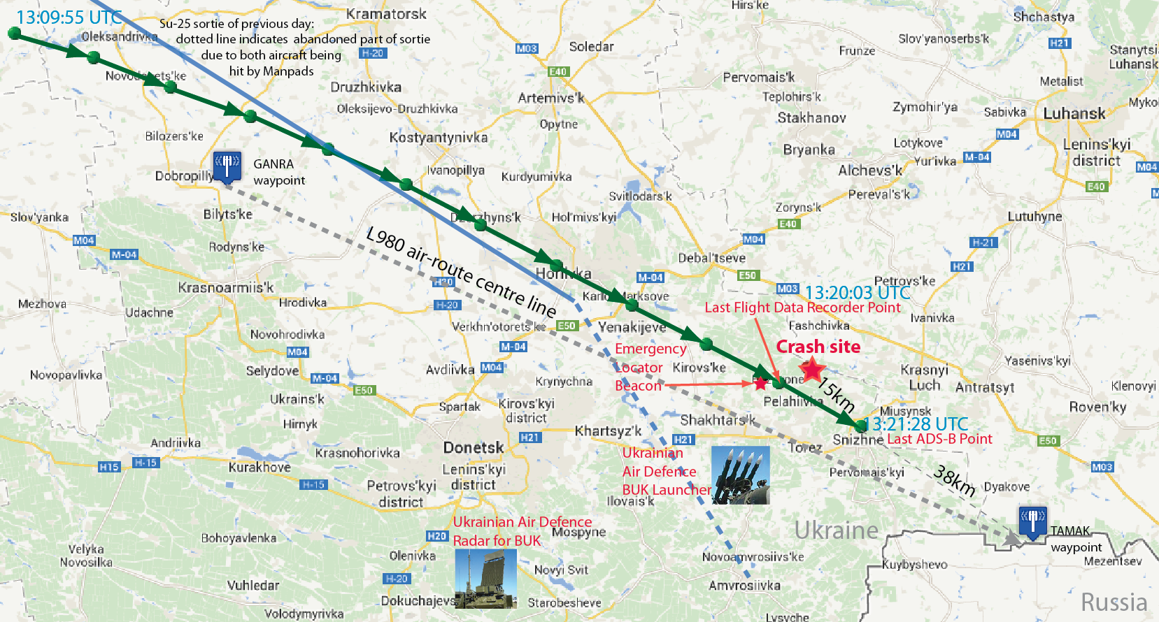 | 1,657 × 890 (920 KB) | Two Dogs (talk | contribs) | Added abandoned Su-25 bombing route from previous day |
| 13:16, 16 September 2014 | 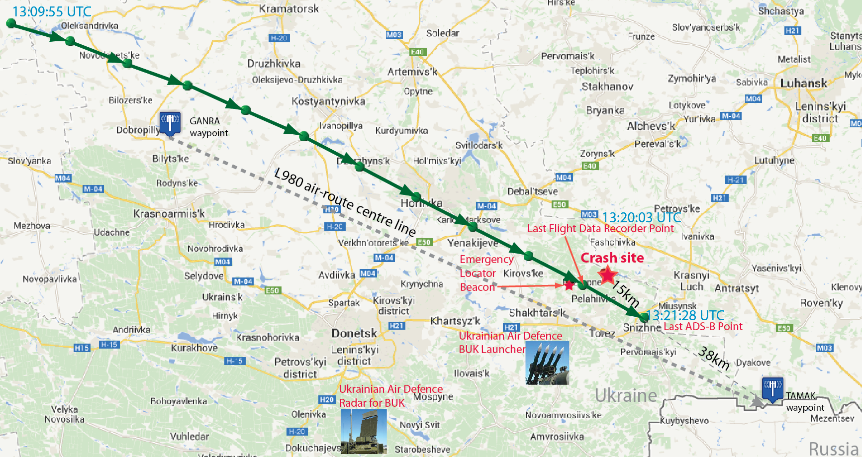 | 1,733 × 919 (904 KB) | Two Dogs (talk | contribs) | Updated incorrectly placed BUK graphic (see discussion) | |
| 09:46, 9 September 2014 | 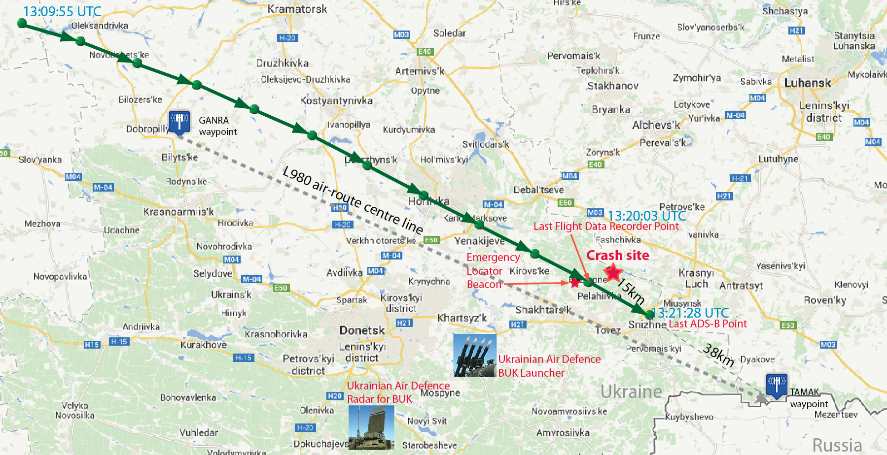 | 1,799 × 924 (933 KB) | Two Dogs (talk | contribs) | Added info from DSB prelim report & Russian intel briefings | |
| 08:27, 19 August 2014 | 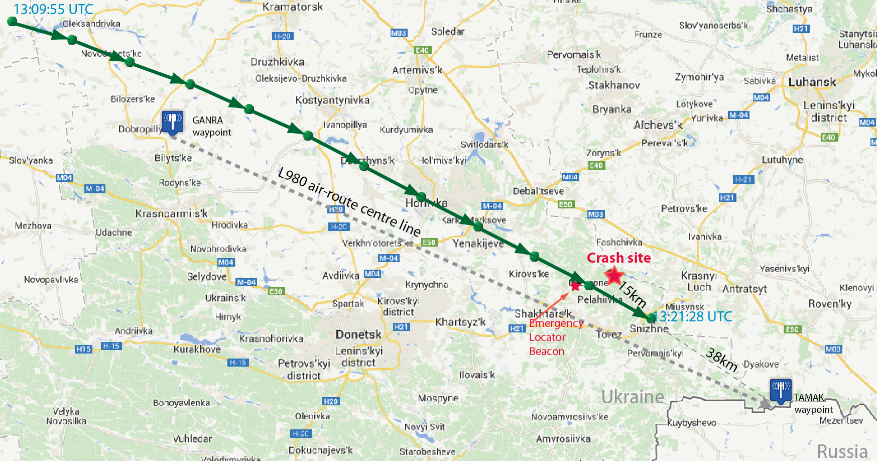 | 1,747 × 918 (861 KB) | Two Dogs (talk | contribs) | Includes Google map | |
| 13:18, 18 August 2014 | 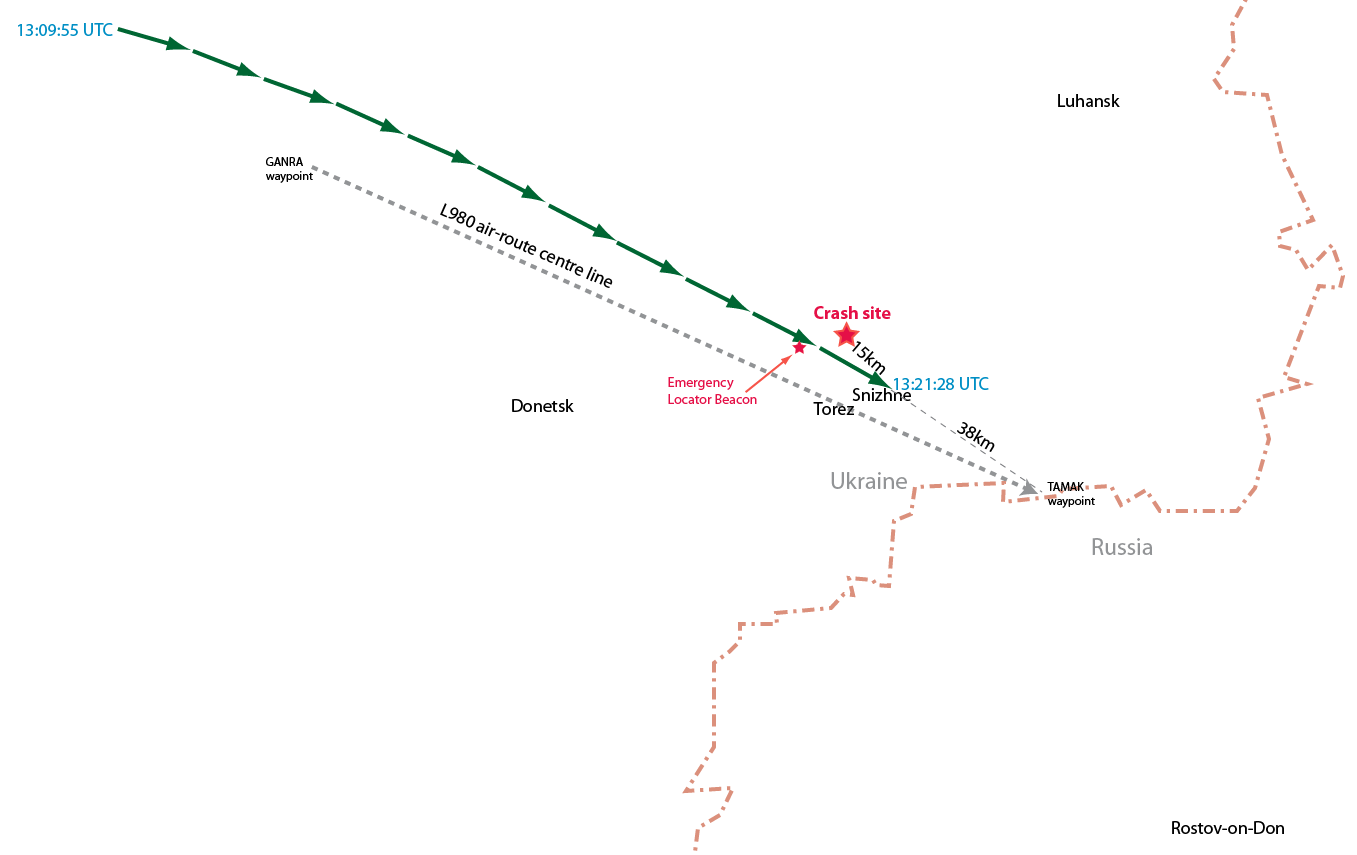 | 1,357 × 855 (69 KB) | Two Dogs (talk | contribs) | Non copyvio version | |
| 13:33, 17 August 2014 |  | 985 × 677 (682 KB) | Two Dogs (talk | contribs) | The green dots are the MH17 position transmissions, the red dots are the crash and ELB locations (overlaid by me). For use only in Talk page - not for publication as the underlying image is copyright Google/Satellite/mapping company. |
- You cannot overwrite this file.
File usage
The following 2 pages uses this file: